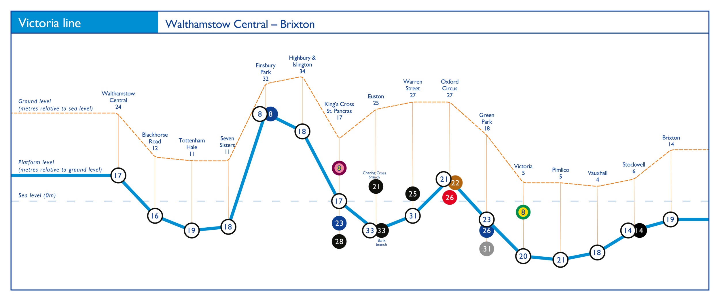
 This is amazing. Daniel Silva has created a series of maps showing just how far underground any given station of the London Underground is. Note that the brown dotted line traces the changes in ground elevation, while the blue line below shows the depth of the railway. Some of the lines (like the Victoria, above) maintain a general consistency of depth in relation to the ground, but others don’t. Silva has created a simple representation of what had to have been some very complicated engineering decisions.